
Learn More
Ask any operations manager how they figure out where their crews and gear are right now, and the honest answer is usually some mix of a group chat, a spreadsheet that was accurate this morning, and a couple of phone calls. It works, sort of. It also falls apart the moment a job runs long, a truck gets diverted, or a client asks for an update you can't give.
X2's Resource Map and Tracking were built to close that gap. Together they turn "where is everyone?" from a question you chase into a screen you glance at.
One map for the whole operation
The Resource Map lives right inside your Resources list. Flip the view from a table to a map and every active resource you own - people and equipment alike - appears as a pin. Nothing to configure per person, no separate app to open. If it's an active resource in X2, it's on the map.
Where a resource carries a device that reports GPS, its pin shows the real, current position. Where it doesn't, X2 falls back to the resource's home city so you still have a sensible anchor instead of a blank space. The two are easy to tell apart at a glance: live positions get a blue marker with a small pulsing green dot, home locations get a quiet grey house icon. A filter at the top lets you show everything, only the live GPS pins, or only the home-based ones, so you can cut straight to "who is actually out and moving" in a click.
When lots of resources sit close together, the map groups them into a single counted cluster rather than a pile of overlapping pins. Click a cluster and the map flies in and expands it; click through to any resource and you land on its full detail record. A running tally in the corner tells you how many of your resources are mapped and how many have no location yet, so you always know how complete the picture is.
The live pins refresh on their own roughly every 90 seconds while you're looking at the map, and pause when you switch away. You get a current view without hammering anything in the background.
From the map to the individual
The fleet view answers "where is everyone." The Tracking tab on each resource answers "what's the full story on this one."
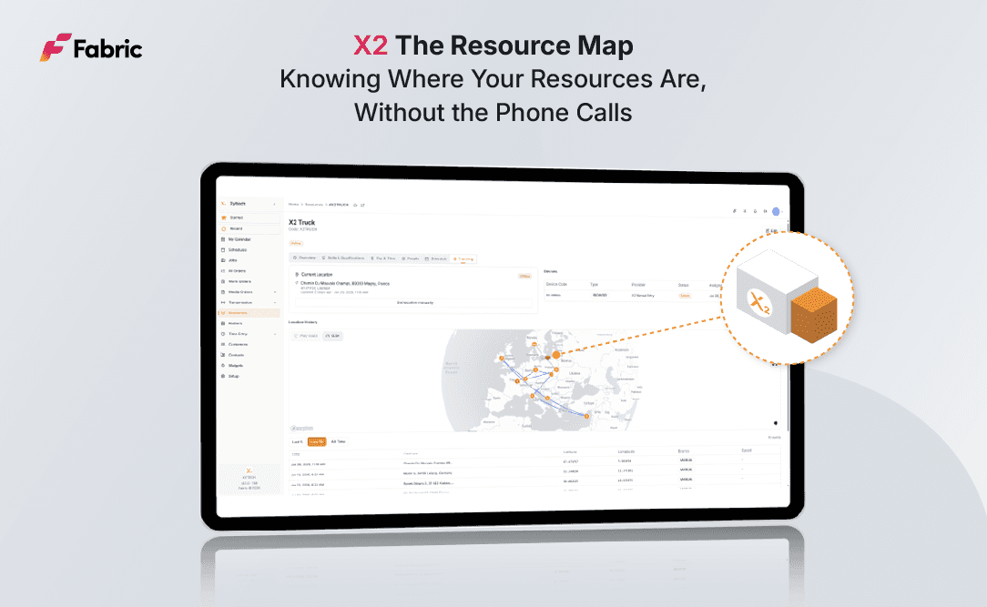
Open any resource and you'll find a Tracking tab that opens with a current-location card: the exact coordinates, the actual street address (X2 reverse-geocodes it for you), when the position was last reported, and when the resource is moving- its speed and heading. A status badge does the interpreting for you. Reported in the last ten minutes reads as Live, up to an hour as Stale, older than that as Offline, so you know instantly whether you're looking at fact or history. That card updates about every 30 seconds on its own.
Not every resource is going to have a dedicated GPS unit, and that's fine. The Tracking tab lets you register devices against a resource (GPS units, mobiles, or a browser) and activate or deactivate them as it gets reassigned. And when you just need to record where something is right now, "Set manually" lets you type an address, pick it from autocomplete, and drop a location on the spot.
Replaying where a resource has been
The part that tends to win people over is the history. Every reported position is kept, and the Tracking tab draws the resource's movements as a route line on the map, with numbered pins marking the recent stops along the way.
Then it lets you press play. A little animated truck drives forward through time along the recorded path, and you can speed the playback up or slow it down to focus on the stretch you care about. Underneath the map, a plain table lists every logged position: time, address, coordinates, how the location was captured, and speed; filtered to the last handful of points or the whole history. For settling a "what time did they actually leave the site" question, or reviewing how a day unfolded, it beats reconstructing events from memory.
Why it matters
None of this asks your team to change how they work. The crews carry the devices they already carry; the resources are the ones already in X2. What changes is what you can see.
Answer client questions in real time instead of promising to find out and calling back. Dispatch against reality and send the nearest available resource because you can see who's nearest. Cut the check-in calls that eat everyone's afternoon. Keep an honest record of where resources were and when, for billing, disputes, or just your own peace of mind.
The Resource Map and Tracking don't try to run your operation for you. They do something simpler and, day to day, more useful: they make sure you're never guessing where your people and equipment are. In a business where a missed handoff or a wrong assumption costs real money, that's a quiet advantage that pays off every shift.
Get the latest from Fabric
Xytech Operations is Fabric's resource and production scheduling platform, built for broadcast organizations, production companies, and live events operations. X2 is its next-generation interface, released in beta at NAB Show 2026 and reaching general availability in October 2026. We publish regular updates on X2, Xytech AI, and the broader Xytech platform roadmap. Follow Fabric on LinkedIn for new articles as soon as they drop.
Fabric is a global media technology company. The Xytech product family, including Xytech Media, Xytech Operations, and Xytech Transmission, powers media lifecycle management, resource scheduling, and transmission workflows for media organizations worldwide.
Similar Articles
We're constantly pushing the boundaries of what's possible and seeking new ways to improve our services. Search your topic of interest.


